New files in: 1 day, 3 days, 7 days, 30 days
| Most downloaded for: all time,
year,
half a year,
month,
two weeks,
three days
Most popular by rating | Submit a file
Most popular by rating | Submit a file
| Folder: |
Растровые карты Австралии + номенклатура карт (index)
→ Size:
246 MB
→ Date:
13 years ago (04.06.2013 20:14)
→ Author:
Commowealth of Australia
→ Approved by moderator:
omega
→ License:
Freeware - Free version, Unlimited Distribution
→ Downloaded:
46 time(s)

Растровые карты Австралии + номенклатура карт (index)
→ Size:
243 MB
→ Date:
13 years ago (22.12.2012 19:38)
→ Author:
Commowealth of Australia
→ Approved by moderator:
RAID
→ License:
Freeware - Free version, Unlimited Distribution
→ Downloaded:
98 time(s)

Maps for VFR flights in high definition. On a scale of 1 and 5 km.
→ Size:
20 MB
→ Date:
14 years ago (28.06.2012 17:00)
→ Author:
Неизвестен
→ Approved by moderator:
SLAVJAN
→ License:
Freeware - Free version, Unlimited Distribution
→ Downloaded:
1021 time(s)
Набор РНК Аляски
| Rating: 5!

Набор РНК Аляски. Карты 2005 года, но для полетов в оффлайне, а может даже и в онлайне (не проверял), подойдет. В данный архив включены все регионы Аляски. Кроме того карты уже настроены для интеграции в программу FSMMoving Map 1.2. Все карты в расширении *.jpg, *.prj и *.jgw.
Инструкция по установке в FSMMoving Map в архиве.
Инструкция по установке в FSMMoving Map в архиве.
→ Size:
60 MB
→ Date:
14 years ago (30.05.2012 23:53)
→ Author:
→ Approved by moderator:
Anton_G
→ License:
License file included in archive
→ Downloaded:
759 time(s)

Растровые карты Австралии + номенклатура карт (index)
→ Size:
260 MB
→ Date:
14 years ago (29.04.2012 08:30)
→ Author:
Commowealth of Australia
→ Approved by moderator:
omega
→ License:
Freeware - Free version, Unlimited Distribution
→ Downloaded:
102 time(s)
15 Australian map's
| Rating: 5!

Растровые карты Австралии + номенклатура карт (index)
→ Size:
270 MB
→ Date:
14 years ago (02.04.2012 03:35)
→ Author:
Commowealth of Australia
→ Approved by moderator:
Jeka_M
→ License:
Freeware - Free version, Unlimited Distribution
→ Downloaded:
92 time(s)

Растровые карты Австралии + номенклатура карт (index)
→ Size:
260 MB
→ Date:
14 years ago (23.03.2012 02:42)
→ Author:
Commowealth of Australia
→ Approved by moderator:
Jeka_M
→ License:
Freeware - Free version, Unlimited Distribution
→ Downloaded:
71 time(s)

Растровые карты Австралии + номенклатура карт (index)
→ Size:
215 MB
→ Date:
14 years ago (22.03.2012 19:13)
→ Author:
Commowealth of Australia
→ Approved by moderator:
Jeka_M
→ License:
Freeware - Free version, Unlimited Distribution
→ Downloaded:
75 time(s)

Растровые карты Австралии + номенклатура карт (index)
→ Size:
240 MB
→ Date:
14 years ago (19.03.2012 03:32)
→ Author:
Commowealth of Australia
→ Approved by moderator:
SLAVJAN
→ License:
Freeware - Free version, Unlimited Distribution
→ Downloaded:
64 time(s)

Растровые карты Австралии + номенклатура карт (index)
→ Size:
269 MB
→ Date:
14 years ago (18.03.2012 06:08)
→ Author:
Commowealth of Australia
→ Approved by moderator:
omega
→ License:
Freeware - Free version, Unlimited Distribution
→ Downloaded:
74 time(s)
Radionavigation charts of Russia 02.2012
| Rating: 5!
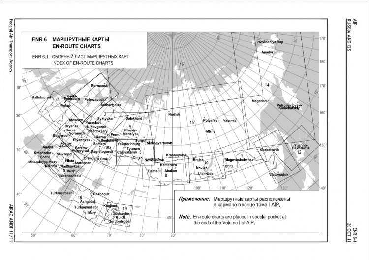
Update of route charts of february 2012 year. Collected lists in one .PDF file. Charsets build-in the document (If not installed on the PC). Full variant of AIP http://aviadocs.net/aip.html these charts are issue date from 9 february 2012. Lavinjer asked :)
→ Size:
36 MB
→ Date:
14 years ago (30.01.2012 21:36)
→ Author:
ЦАИ ГА, МИНТРАНС
→ Approved by moderator:
SLAVJAN
→ License:
Freeware - Free version, Do Not Redistribute
→ Downloaded:
5893 time(s)
РНК 1-6, 8
| Rating: 5!

Карты 2010 года, привязаны к OziExplorer, разрешение и качество хорошее. Листы 1-6, 8.
→ Size:
222 MB
→ Date:
14 years ago (29.01.2012 15:12)
→ Author:
ЦАИ ГА
→ Approved by moderator:
Alex_buka
→ License:
Freeware - Free version, Unlimited Distribution
→ Downloaded:
781 time(s)
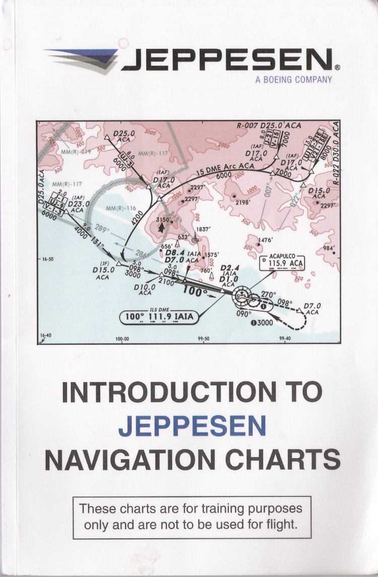
The chart training guide is published as a service for pilots training
with Jeppesen charts. It is intended for reference only and
includes some of the most commonly used symbology. Not all
symbology is included with this guide. This guide is revised regularly;
however, some variance may exist between this guide and
current chart services. These may be the result of one or more
of the following; chart issuance dates, timely application of
changes received from governing agencies and / or the method
of representing such information. Some of the charts used in this
guide are based on a fictitious location. The chart training guide
has been designed as supplementary training material and is
not intended for navigation.
→ Size:
25 MB
→ Date:
14 years ago (20.11.2011 18:40)
→ Author:
Jeppesen Sanderson, Inc. 55 Inverness Drive East Englewood, CO 80112-5498 USA Tel: 303.799.9090
→ Approved by moderator:
UEMJ
→ License:
Freeware - Free version, Unlimited Distribution
→ Downloaded:
4695 time(s)
Introduction to navigation charts
| Rating: 5!
E3B 2007
| Rating: 5!

Как то скачивал отсюда РНК Европы, а при использовании выяснилось, что вышеуказанный квадрат отсутствует. Данный квадрат включает в себя Польшу, Восточную Германию, Чехию.
→ Size:
3 MB
→ Date:
14 years ago (11.11.2011 02:33)
→ Author:
ЦАИ ГА
→ Approved by moderator:
SLAVJAN
→ License:
Freeware - Free version, Unlimited Distribution
→ Downloaded:
801 time(s)