Airnavigation charts Azerbaijan, 2014 Просмотр ZIP-архива
55549-AZERBAIJAN-NAVIGATION-CHARTS.zip
| Имя файла | Дата | Размер |
|---|---|---|
| AZERBAIJAN NAVIGATION CHARTS.jpg | 22.12.2014 01:36 | 2 MB |
| avsim_su.diz | 21.12.2014 23:58 | 406 B |
| Итого: | 2 MB | |
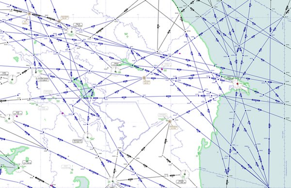
Decided to make aeronautical charts of the country, took advantage of a resource Sky Vector, gathered into one all over the country , as there are border countries - Russia , Georgia , Iran and Armenia . Map enough in high resolution. Use of health .
→ Size:
2 MB
→ Date:
11 years ago (21.12.2014 21:08)
→ Author:
AZAL
→ Approved by moderator:
dmi-shef
→ License:
Freeware - Free version, Unlimited Distribution
→ Downloaded:
222 time(s)