Coast Line Maker V2.0 Просмотр ZIP-архива
Documentation/Instructions.html
<!doctype html public "-//w3c//dtd html 4.0 transitional//en">

<html>

<head>

   <meta http-equiv="Content-Type" content="text/html; charset=iso-8859-1">

   <meta name="AUTHOR" content="Iain Murray">

   <meta name="GENERATOR" content="Microsoft FrontPage 4.0">

   <title>Coast-Line-Maker - Instructions</title>

</head>

<body text="#0000FF" bgcolor="#00FFFF" link="#FF0000" vlink="#800000">


<h1>

Instructions - Coast-Line-Maker V2.0</h1>


<h3><i>© Iain Murray, 2003</i></h3>


<hr>

<h3>

About Coast-Line-Maker V2.0</h3>

<p><b>Coast-Line-Maker</b> is a utility designed to allow manipulation of the coastlines in
Microsoft's <b> Flight Simulator 2002 </b>- existing coastal segments can be
deleted or edited, and new ones added. <b>  Coast-Line-Maker</b> also allows
manipulation of other line segments, such as rivers and roads. The main features
of <b>Coast-Line-Maker</b>  were conceived as follows:</p>

<ul>
  <li><b>graphic-oriented</b> design screen, allowing easy placement of line segments</li>
  <li>requires <b>no user knowledge</b> of programming, assembler files or hex
    editing</li>
  <li>coverage over <b>more than one</b> LOD13 cell - <b>  Coast-Line-Maker</b>
    can handle an entire LOD8 cell in one project</li>
  <li><b>automatic alignment</b> between coastline segments and land/water polygons</li>
  <li><b>automatic generation</b> of assembler source files, with automatic compilation
    and copying of new scenery BGLs to <b>FS2002</b> scenery folder</li>
  <li>facility to rework <b> river/stream </b> and <b> road</b> segments too</li>
  <li>facility to save <b>  Coast-Line-Maker</b>  projects and reload them for
    editing</li>
</ul>

<p><b>FS2002</b> coastlines are created in a different way from earlier versions of
Flight Simulator. The world is divided in to a 768 x 512 grid of cells (called
LOD8 cells) -
initially water, but main land areas are set up by block filling certain cells
with land. The actual land/water margin detail is then set up using a finer cell grid
(32 x 32 LOD13 cells within each larger LOD8 cell) using Land & Water Masks (LWMs). These are
essentially a series of polygons which are either land or water, and are used to
mask out the underlying land/water to achieve the correct coast shape.</p>

<p>Oddly, any coastlines (i.e. beaches, waves etc.) are <i> not</i> defined as part of this process, but are created
<i>
separately</i> using Vectored Terrain Polygons (VTPs) - this is the same technique used to
create roads etc. in the <b>FS2002</b> world. Coastlines can be created either with or
without breaking waves (the waves are generated automatically by <b> FS2002</b> if the
VTP coastline is set up correctly).</p>


<p>LWMs and VTPs are normally defined within scenery assembler source files, and
compiled using the MS scenery compiler <b> BGLC</b> (part of the MS SDK for <b>FS2002</b>) to
produce scenery BGL files for <b>FS2002</b>.</p>


<p><b>Coast-Line-Maker</b> was designed to allow coastlines to be drawn graphically on the
screen, and then generate the corresponding LWM and VTP assembler source files
automatically - the program will even compile these assembler files and copy the
resulting scenery BGL files directly to your <b>FS2002</b> scenery folder.</p>


<p><b><img border="0" src="devawar2.gif" width="131" height="100">
Coast-Line-Maker</b>  won a FLIGHTSIM Developer's Award from <a href="http://WWW.FLIGHTSIM.COM">WWW.FLIGHTSIM.COM</a>
for January 2003.</p>


<hr>

<h3>

Getting Started: Coast-Line-Maker first time setup </h3>

<ul>
  <li>Create a new folder, and into it copy the <b>CoastLineMaker</b><b>.EXE</b>
    file and the <b> Documentation</b> subfolder (with its contents)</li>
</ul>


<p>This is the folder within which you should also store any background map
images and your <b>Coast-Line-Maker</b>
 data files (which have a <b><font face="Courier New"> .CLM</font></b> extension).</p>


<p>You will also require the following tools to complete a <b>Coast-Line-Maker</b>
 project, which should be copied into the same folder as above:</p>


<ul>
  <li>a copy of the MS scenery
compiler <b>BGLC.EXE</b> (from the Microsoft BGL compiler SDK available at <a href="http://zone.msn.com/flightsim/FS02DevDeskSDK15.asp">http://zone.msn.com/flightsim/FS02DevDeskSDK15.asp</a>)</li>
  <li>a copy of files <font face="Courier New"><b>TDFMacros.inc </b></font>and <font face="Courier New"><b>TDFHeaders.inc</b></font>
    - these files (by Richard Ludowise) are needed for successful compilation of
    the scenery and are included in the <b>Coast-Line-Maker</b>   package </li>
  <li>a copy of files <font face="Courier New"><b>Cell_Grid.inc</b></font> and <font face="Courier New"><b>192_127_Grid.txt</b></font>
    - these files (by Richard Ludowise) from his <font face="Courier New"><b>CellGrid</b></font><font face="Courier New"><b>2.ZIP</b></font>
    are included in the <b>Coast-Line-Maker</b>   package </li>
</ul>


<p>For basic troubleshooting information for <b>Coast-Line-Maker</b> (if you
have any problems getting the program to run), please see
<b><font face="Courier New">README.TXT.</font></b></p>


<hr>

<h3>

Getting Started: The Coast-Line-Maker Design Process </h3>

<p>A worked example of reworking a simple coast with <b>Coast-Line-Maker</b>
 is given in the accompanying <a href="Tutorial.html">Tutorial</a>.</p>

<p>The best way to use <b>Coast-Line-Maker</b>  is as follows:</p>

<ul>
  <li>find the cell co-ordinates of your "target region"</li>
  <li>create a background map showing your "target region" - this can
    be a screen capture from <b>FS2002</b> map view</li>
  <li>within <b>Coast-Line-Maker</b>, add new coastline segments where
    required</li>
  <li>within <b>Coast-Line-Maker</b>, add land and water polygons around the new
    coastline to mask off any existing land/water that is not needed</li>
  <li>within <b>Coast-Line-Maker</b>, clear existing segments which are no
    longer needed from cells</li>
  <li>within <b>Coast-Line-Maker</b>, add any other segments (rivers, roads
    etc.) if required</li>
  <li>save the VTP and LWM data as assembler files, assemble them with <b>BGLC</b>
    and copy the new scenery BGL files to <b>FS2002</b> (<b>Coast-Line-Maker</b> can
    do this automatically for you)</li>
</ul>


It is recommended that you save your <b>Coast-Line-Maker</b> project after <i>each</i>
of the above stages.
<p>The data flow of the <b>Coast-Line-Maker</b>   design process is as follows:</p>
<p align="center"><img border="0" src="Flowchart.gif" width="494" height="488"></p>


<hr>

<h3>

Getting Started: Making a background map </h3>

<p><b>Coast-Line-Maker</b> needs a background map upon which to draw the coastline. The best
map to use is a map captured from the map view of <b> FS2002</b> itself, over
which is
laid the LOD13 cell pattern and/or a map of the real coastline which you wish to
follow. <i>The accuracy of placement of your new coastline etc. within </i> <b>FS2002</b>
<i>
will depend on the accurate drawing of the background map!</i></p>

<p>To produce this map, follow these steps:</p>

<ul>
  <li>Open <b>FS2002</b> and go to the middle of the target area in which you
    wish to change the coastline; note the latitude and longitude co-ordinates
    (see them by hitting <b><i>Shift-Z </i></b>or in <b><i>Map View</i></b>).</li>
  <li>Use <b>Coast-Line-Maker</b>'s <b> </b>Cell Calculator (menu <b><i>Help /
    Cell Calculator</i></b>) to find the LOD8 cell containing the target
    co-ordinates.</li>
  <li>Use the <b>CellGrid</b> files (included as part of this package) to generate a
    visible grid BGL for this LOD8 cell (edit the name and content of the given <font face="Courier New"><b>
    192_127_grid.txt</b></font> to reflect the required LOD8 cell co-ordinates, then
    drag-and-drop this file onto <font face="Courier New"><b>BGLC.EXE</b></font>
    to compile the scenery BGL); copy the grid BGL to an active <b>FS2002</b> scenery
    folder (remember to copy the grid texture <font face="Courier New"><b>LOD8define.bmp</b></font>
    to the corresponding texture folder too). It can be useful to have a
    separate scenery subfolder for all the grids, thus allowing all of them to
    be turned on or off easily via the <b>FS2002</b>  Scenery Library.</li>
  <li>Open <b>FS2002</b>;
    go to <b><i>Map View</i></b> in the target area to see the grid on the
    ground. Use the zoom controls to fill the screen with the area containing
    the coast to be modified (N.B. if this area is in more than one LOD8 cell, you
    will have to perform this process for <i>each</i> LOD8 cell). Use the rotate
    controls to <i>get the grid running parallel to the sides of the screen</i>.
    Press <b><i>Alt-PrtSc</i></b> to capture the screen, then paste this into
    your favourite bitmap drawing program (e.g. <b>MS Paint</b>, <b>Paint Shop
    Pro</b> etc.). Crop the image to include only the rows and columns and cells
    to be edited - your image should thus contain only a number of <i>complete
    cells</i> - see the <a href="Tutorial.html">Tutorial</a> for examples of
    good and bad map images. </li>
  <li> If required, use your art program to overlay this image with an
    actual map of the target area - many online maps are available, which you
    can download and edit together to cover your target area. Online maps are
    available from sites including:
    <ul>
      <li><a href="http://www.multimap.com/">http://www.multimap.com/</a></li>
      <li><a href="http://www.streetmap.co.uk/">http://www.streetmap.co.uk/</a></li>
    </ul>
  </li>
  <li> Save your modified image - <b>Coast-Line-Maker</b> will accept images in BMP,
    GIF or JPG format. It is suggested that you reduce the colour depth to 256
    or 16 colours (especially if the image dimensions are large) in order to
    keep the image file size manageable. <b>Coast-Line-Maker</b> will accept
    large images - it has been tested with images 6000 x 5000 pixels!</li>
</ul>


<hr>

<h3>

Using Coast-Line-Maker </h3>

<ul>
  <li>Run <b>Coast-Line-Maker</b>, and load the map created above as the background
    image. In the <b><i>Background Properties</i></b> dialog, enter the details
    required (the LOD8 co-ordinates already found, and the co-ordinates of the
    LOD13 cells in the <i>top left</i> and <i>bottom right</i> corners of your
    background image).</li>
  <li>Select <b><i>Output / Preferences</i></b> and enter a root filename (the
    names of the LWM and VTP assembler files will be generated from this root) and select
    any other preferences as required. You may also elect to compile your new
    files and copy them to your <b>FS2002</b> scenery folder. </li>
  <li>Now you are ready to draw on your coastline (you must do this <b><i>before</i></b>
    you add LWM polygons, as the coastline will be used as the edge of the
    polygons) - from the combo box, select one of the coastline options -
    usually <b><i>Coastline (sand) with
    waves</i></b> </li>
  <li>Click on the map at the start of your new coast segment - this will
    usually be at the <i>edge</i> of an LOD13 cell at the point where the <i>existing</i>
    coast is (as you will usually want to connect your new coast segment to an
    existing coast segment)</li>
  <li>Continue along the coast, clicking at significant turning points as you go
    - a segment will usually also <i>end</i> on the edge of an LOD13 cell. If a <i>separate</i>
    coastal segment is to be added, click on <b><i>Start new segment</i></b>,
    then click along the new segment. Note that you must place <i>at least one
    coast point within each LOD13 cell which the coastline passes through</i>
    ... if there is a long straight stretch of coastline, <i>do not</i> simply
    click at the start and end!</li>
  <li> If a point is to be repositioned, select it (either by
    right-clicking near it on the map or by selecting it from the list) then
    either drag-and-drop the point, or click <b><i>Edit point </i></b>and enter new
    numerical co-ordinates for the selected point (in either cell- or VTP-related
    format). This function is particularly useful if the scale of your map makes it difficult to achieve precise positioning of the mouse over the map.</li>
  <li>To help achieve exact positioning of points on cell edges, check the <b>Snap
    to cell border </b>option - if the mouse is within 5 pixels of the cell
    edge, it will snap to the nearest edge automatically.</li>
  <li>The <b><i>Current segment Width </i></b>setting can be used to change the width of
    individual VTP segments - settings of <b>80</b> (for coastline segments) and <b>40</b>
    (for road segments) are similar to MS default settings. If you wish to
    resize a segment, enter the new width in the text box, select a point within
    the required segment in the list box, then click <b><i>Change segment width</i></b>.</li>
  <li>Note that land and water mask polygons are textured <i>automatically</i>
    by <b>FS2002</b> - land will assume the textures of the underlying
    landclass,
    and water will automatically assume the shimmering water texture. Also, any
    joins between polygons of the same type will <i>not</i> be visible in the
    simulator!</li>
  <li>If you are making a sea coastline, you will normally set <b>land polygons
    to conform</b> to existing terrain, and set <b>water polygons to fixed
    height of 0m</b>. If you are doing lakes etc., then water should again be a
    fixed height, but this time the height ASL of the lake surface. You can also
    rework terrain elevations to a limited degree with land polygons set to
    specific heights. When selecting land or water polygons, <b>Coast-Line-Maker</b> will
    <i>automatically</i> set the default height option for the polygon type.</li>
  <li>Note that your new VTP and LWM BGL files must <b><i>not</i></b>  be in the
    main <b>FS2002</b>  Scenery folder - they should be in a separate scenery
    subfolder which has a <b><i>higher priority</i></b>  than the default
    scenery (this may be a special folder for your coastlines, or an existing
    folder with other scenery items in it) - for example (folder tree on left, Scenery
    Library window on right):


<p align="center"><img border="0" src="Folders.gif" width="414" height="253">
<img border="0" src="SceneryLibrary.gif" width="639" height="269"></p>

  </li>
</ul>


<hr>

<h3>

Testing out your new coastline / Troubleshooting</h3>

<ul>
  <li>If you have not set Coast-Line-Maker to automatically copy the output,
    then manually copy the BGL file(s) generated by <b>Coast-Line-Maker </b>/ <b>BGLC</b> to an
    active scenery subfolder in <b>FS2002</b> (see above for example). Run <b>FS2002</b>, and go to your
    target area - you should see the new coastline that you created in<b>
    Coast-Line-Maker</b>.</li>
  <li>The following common problems are easily resolved:
    <ul>
      <li>if old coastline in revised cells does <b><i>not</i></b> disappear,
        you probably have your scenery folders in the wrong order - see above
        for information on how to set up your folders correctly</li>
      <li>if any of the coast segments are the wrong way round (i.e. the beach is on
    the water side and the waves are on the land side), then
    select a point within that coast segment and click on <b><i>Reverse segment</i></b>,
    then resave the VTP file</li>
    </ul>
    <p align="center"><img border="0" src="BadBeach.gif" width="400" height="195">
    <ul>
      <li>if the ends of your new VTP segments do not match well with existing
        segments, your background map is probably slightly out of alignment -
        the simplest fix is to nudge the misaligned segment ends the right way
        in Coast-Line-Maker, then resave the VTP file. If you have to nudge them
        quite far, you may need to reposition any adjacent LWM polygons too, and
        resave the LWM file</li>
      <li>if the VTP segments and LWM edges do not match, you have probably
        repositioned the VTP segment after drawing the LWM polygon - delete the
        current LWM polygon and redraw to the new VTP shape, then resave the LWM
        file</li>
      <li>if any VTP segments have unexpectedly vanished from LOD13 cells
        adjacent to where you placed new segments, you may have to nudge the
        endpoints of your segments <i> inwards</i> (away from the problem cell), then resave the VTP
        file</li>
    </ul>
    <p align="center"><img border="0" src="LostCoast.gif" width="400" height="246">
  </li>
  <li>The following problem is less easily resolved - sometimes when land
    polygons are placed <i>correctly</i> in LOD13 cells, the land simply does <b><i>not
    appear</i></b> (note that coast segments with waves will appear <b><i>without
    waves</i></b> in such an area, which is a good test to see if this is indeed
    the cause of the problem; see image below). The problem is with the underlying
    landclass
    in this area, which is set to <i><b>water</b></i>, and for this reason, you <b><i>cannot</i></b>
    get land to appear in this cell using <b>Coast-Line-Maker </b>alone.
    Experience suggests that land-type landclass <i>does not extend very far out
    to sea</i> from the default MS coastline! There are two solutions to this
    problem:
    <ul>
      <li><b>cheat solution</b>: move the VTP segment so that it does not pass
        through the problem cell (obviously this will not be practical for all
        cases!)</li>
      <li><b>proper solution</b>: edit the
    LandClass in the area to set it to a land type; several LandClass tools are
        available, including:
        <ul>
          <li>Landclass Assistant by John Cillis - freeware available from <a href="http://www.flightsim.com">FLIGHTSIM</a>
            and <a href="http://www.avsim.com">AVSIM</a></li>
          <li>FSLandClass by Burkhard Renk - shareware available from <a href="http://www.fssharecenter.com/fslandclass/">FSShareCenter</a></li>
        </ul>
      </li>
    </ul>
  </li>
</ul>


<p align="center"><img border="0" src="MissingTileCLM.gif" width="523" height="555">
<img border="0" src="MissingTile.gif" width="641" height="290"></p>


<hr>

<h3>

 Coast-Line-Maker - Caveats and Limitations</h3>

Please note the following usage idiosyncrasies of <b>Coast-Line-Maker </b>and
its output:

<ul>
  <li>Remember that you must place <i>at least one VTP segment point within each LOD13 cell which the
    segment passes through</i>.
    Where a coast segment crosses an LOD13 cell without a point in that cell,
    the coastal segment will be ignored when placing LWM polygons. Where a
    point at one end of a coast segment is placed on the edge of a cell, you
    should also place at least one point <i>within</i> that cell. During
    testing, most faults in the program output were due to coastal segments
    passing through cells with no points in those cells! The <b>Check VTP data </b>function
    will scan your VTP data and warn you of any offending segments.</li>
</ul>


<p align="center"><img border="0" src="CornerCut.gif"></p>

<ul>
  <li><i><b>Do not</b> </i>place VTP segment points <i> precisely</i> at LOD13 cell <i>corners</i> - you
    can place the point <i>very close</i> to the corner (e.g. co-ordinates 1 and
    254), but avoid the corner itself (co-ordinates 0 and 255)</li>
  <li>Coast segments should <b><i>never cross over </i></b>one another - LWM
    polygons may be placed incorrectly if they do</li>
  <li>LWM polygons will form themselves to coastline segments, but will ignore
    other segments such as rivers and roads</li>
  <li>Having clicked in a LOD13 cell to place an LWM polygon, <b>Coast-Line-Maker</b>
    uses a very simple algorithm to detect <i> which</i> of the possible polygons within the cell
    you have selected. This algorithm is not 100% accurate, so if the <i> wrong</i> LWM
    polygon is created, select it from the list, delete it and click again - try to click
    near the <i>centre point</i> of the polygon that you wish to select.</li>
  <li>LWM polygons should be <i> convex</i> in shape, otherwise they may not be
    displayed correctly (this is actually a limitation of Flight Simulator
    itself). Any
    potential <i> concave</i> polygons may need to be broken down into convex shapes, using
    plain coast segments as edges.</li>
  <li>Although LWM polygons are aligned with VTP segments <i>at the time they
    are drawn</i>, they are then unconnected with the VTP points. If the latter
    are moved, you may need to delete previously drawn LWM polygons and <i>redraw</i>
    to align to the new VTP points.  </li>
  <li>Note that Plain segments <i>deliberately</i> <i>do not appear</i> in the VTP output -
    they are used simply to act as the edges of the LWM polygons</li>
  <li><b>FS2002</b> will draw the LWM polygons in the order listed in <b>Coast-Line-Maker</b>.
    Careful ordering can be used to build up layer effects, such as <i>land</i>
    then a <i> lake</i>
    (water polygon) then an <i> island</i> (land polygon) on top of it. LWM
    polygons can be re-ordered by selecting one on the list, then right-clicking
    and select to move it up (<i>draw earlier</i>) or down (<i>draw later</i>)
    the list.</li>
</ul>


<p align="center"><img border="0" src="Islands.gif" width="1150" height="270"></p>

<ul>
  <li>If an error with <b>BGLC</b> is reported when saving the files, try the
    save again (the compilation will timeout if your machine is busy with other
    processes) - note that for the compilation and copy to be successful, <b>FS2002</b>
    must <i>not </i>be running at the same time.</li>
  <li>A <b>Coast-Line-Maker</b>
    project can have up to 3000 VTP points, 500 LWM polygons and 2000 cell
    deletes</li>
  <li>By default, adding new coast within an LOD13 cell will remove any existing
    coast in the cell ... if you wish to retain the existing coast in a cell
    (e.g. to add a new lake near an existing coast),
    then within the VTP ASM file, use <b>Notepad</b> to edit the lines beginning with  <font face="Courier New"><b>VTPLayer</b></font>
    to change the final "<font face="Courier New"><b>1</b></font>" to a "<font face="Courier New"><b>0</b></font>"</li>
  <li><b>Coast-Line-Maker </b>requires you to consider each LOD8 cell as a
    separate project; if your project covers several LOD8 cells, you will thus
    generate several LWM BGLs and several VTP BGLs. To reduce the number of BGL
    files, you can combine your ASM files together using the <b>LinkCLM</b>
    program by Dietmar Frenzl, which is included with the <b>Coast-Line-Maker</b>
    <b>V2.0 </b>package; it will combine a number of ASM files produced using <b>Coast-Line-Maker
    </b>to produce a single VTP BGL and single LWM BGL
    file.
    See the <b>LinkCLM</b> documentation within the package for details of using
    <b>LinkCLM</b>.</li>
</ul>


<hr>

<h3>

Revision History</h3>

<ul>
  <li>V1.0 - 22 Jan 2003 - beta test version</li>
  <li>V1.1 - 27 Jan 2003 - 1st general release</li>
  <li>V1.1.1 - 03 Feb 2003 (patch):
    <ul>
      <li>fixed a bug encountered when loading files larger than 32K (previously
        saved CLM files will still work OK, whether larger or smaller than 32K)</li>
      <li>fixed a bug when a polygon overflow occurs (no longer loops
        indefinitely)</li>
      <li>fixed a bug with longitudes > <sup>+</sup>/- 90<sup>o</sup></li>
      <li>added a "New Project" feature</li>
      <li>added a "Check VTP data" feature; this will proof-check the
        VTP to look for segments which will/may cause errors in output</li>
    </ul>
  </li>
  <li>V1.1.2 - 07 Feb 2003 (patch):
    <ul>
      <li>added a drag-and-drop feature for VTP points (right-click to select
        the point first)</li>
      <li>added a list of recently-used projects to the File menu</li>
      <li>added an undo feature for the last VTP point that was moved (by
        dragging or editing)</li>
      <li>used an INI file to save program settings on exit</li>
      <li>offered a choice of ASM filenames to save data to</li>
      <li>offered ability to open ASM files in any text editor of your choice</li>
      <li>opened the Instructions and Tutorial in your default web browser,
        rather than IE</li>
      <li>fixed a language-dependent bug in the load/save routines</li>
      <li>fixed a minor bug in the data check routine</li>
    </ul>
  </li>
  <li>V2.0 - 25 Feb 2003 - 2nd general release:
    <ul>
      <li>added the ability to create LWM polygons where there are (single or multiple) coast   segments wholly or partly within one LOD13 cell</li>
      <li>allowed LWM polygons to be re-ordered (by right-clicking on LWM list)</li>
      <li>allowed an LWM polygon to be reshaped to fill the entire LOD13 cell</li>
      <li>revised the "Check VTP data" feature to take account of the above (fewer error   conditions)</li>
      <li>improved the functionality of the automatic compiling and BGL copying process</li>
      <li>added a "Same as CLM" button to the Output Preferences dialog to allow the project   CLM file path to be as the file path for the output ASM files</li>
      <li>added tooltips to most buttons and other dialog objects</li>
      <li>increased project data sizes</li>
      <li>included <b>LinkCLM</b> package</li>
    </ul>
  </li>
</ul>


<hr>

<h3>Coast-Line-Maker Online Gallery</h3>

<p style="margin-top: 0; margin-bottom: 0">Examples of <b>Coast-Line-Maker</b>
use,
contributed by a range of users from around the world, are available to view on
the <a href="http://flightsim.computing.dundee.ac.uk/fsCLM3rd.html"> Coast-Line-Maker
user examples page</a>.</p>


<p style="margin-top: 0; margin-bottom: 0"> </p>


<hr>

<h3>

Acknowledgements and Legal Notice</h3>

<p style="margin-top: 0; margin-bottom: 0">Thanks to many subscribers to the
AVSIM scenery design forum (especially Richard Ludowise) for helpful comments
made in the forum, or to me directly. Without these comments, writing <b>Coast-Line-Maker</b>
would not have been possible. Special thanks to:</p>
<blockquote>
  <ul>
    <li>Richard Ludowise for permission to use his include files (which are in
      the public domain) within the <b>Coast-Line-Maker </b>package</li>
    <li>Dietmar Frenzl for permission to use his <b> LinkCLM</b> within the <b>Coast-Line-Maker
      </b>package</li>
    <li>all users of earlier versions of <b>Coast-Line-Maker</b> for their
      positive feedback and suggestions for improvements</li>
  </ul>
</blockquote>
<p>The<b> Coast-Line-Maker</b> program is distributed as Freeware but remains ©
Iain Murray, 2003, all rights reserved; it may not be distributed commercially
by any means without the express written permission of the author. Any sceneries
created using <b>Coast-Line-Maker</b> are the copyright and property of the
scenery author, but where such scenery is published (either commercially or as
Shareware or as Freeware), the scenery author should acknowledge the use of <b>Coast-Line-Maker</b>
in its creation; as a courtesy, the scenery author should also inform the <b><a href="mailto:[email protected]">Coast-Line-Maker</a></b><a href="mailto:[email protected]">
author</a> of publication.</p>


<p><b>Coast-Line-Maker</b> should not harm your computer or any data stored on it
but, if you imagine that it has, the author accepts no liability.</p>


<hr>

<p>Go to <a href="http://flightsim.computing.dundee.ac.uk">Iain Murray's flight simulator

page</a><p>Send an <a href="mailto:[email protected]">e-mail to
Iain Murray</a>
<p> </p>

</body>

</html>
coastlm2.zip
| Имя файла | Дата | Размер |
|---|---|---|
| Documentation/BadBeach.gif | 29.01.2003 13:40 | 45 KB |
| Documentation/CornerCut.gif | 29.01.2003 13:40 | 47 KB |
| Documentation/devawar2.gif | 17.08.1999 12:29 | 10 KB |
| Documentation/Dialog1.gif | 29.01.2003 13:40 | 10 KB |
| Documentation/Dialog2.gif | 29.01.2003 13:40 | 140 KB |
| Documentation/Dialog3.gif | 28.02.2003 01:03 | 127 KB |
| Documentation/Dialog4.gif | 28.02.2003 01:07 | 130 KB |
| Documentation/Dialog5.gif | 28.02.2003 01:10 | 130 KB |
| Documentation/ErrolBackBad1.gif | 29.01.2003 13:41 | 125 KB |
| Documentation/ErrolBackBad2.gif | 29.01.2003 13:41 | 129 KB |
| Documentation/ErrolBackground.gif | 29.01.2003 13:42 | 536 KB |
| Documentation/ErrolBackSmall2.gif | 29.01.2003 13:42 | 137 KB |
| Documentation/ErrolFixed.jpg | 29.01.2003 13:42 | 62 KB |
| Documentation/ErrolOriginal.jpg | 29.01.2003 13:42 | 57 KB |
| Documentation/Flowchart.gif | 26.01.2003 00:01 | 12 KB |
| Documentation/Folders.gif | 24.02.2003 15:09 | 4 KB |
| Documentation/Instructions.html | 28.02.2003 17:03 | 28 KB |
| Documentation/Islands.gif | 28.02.2003 01:13 | 146 KB |
| Documentation/LostCoast.gif | 29.01.2003 13:42 | 61 KB |
| Documentation/MissingTile.gif | 24.02.2003 15:34 | 107 KB |
| Documentation/MissingTileCLM.gif | 24.02.2003 00:29 | 96 KB |
| Documentation/PerthCLM.gif | 29.01.2003 13:43 | 310 KB |
| Documentation/PerthFixed.jpg | 29.01.2003 13:43 | 93 KB |
| Documentation/PerthOriginal.jpg | 29.01.2003 13:43 | 92 KB |
| Documentation/SceneryLibrary.gif | 24.02.2003 12:57 | 18 KB |
| Documentation/Tutorial.html | 28.02.2003 17:04 | 12 KB |
| 192_127_Grid.txt | 28.01.2003 15:40 | 70 B |
| Cell_Grid.inc | 10.10.2002 19:37 | 181 KB |
| CLM-thumb.gif | 28.02.2003 16:34 | 7 KB |
| CoastLineMaker.exe | 28.02.2003 17:00 | 220 KB |
| LinkCLM.ZIP | 28.02.2003 17:05 | 337 KB |
| LOD8define.bmp | 03.10.2002 15:31 | 86 KB |
| README.TXT | 28.02.2003 16:20 | 8 KB |
| TDFHeaders.inc | 10.09.2002 20:16 | 3 KB |
| TDFMacros.inc | 13.09.2002 14:25 | 16 KB |
| avsim_ru.diz | 14.03.2004 00:16 | 382 B |
| Итого: | 3 MB | |
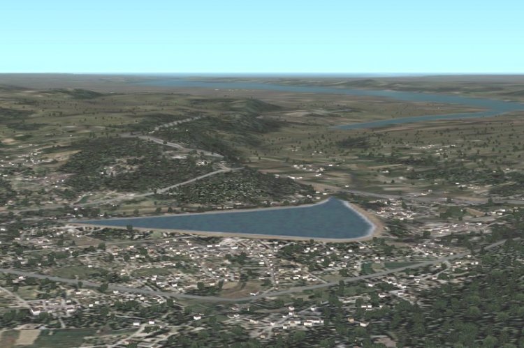
The program for creating landscapes in FS2002
→ Size:
3 MB
→ Date:
23 years ago (01.03.2003 13:43)
→ Author:
Iain R. Murray
→ License:
Freeware - Free version, Do Not Redistribute
→ Downloaded:
427 time(s)