Консольная програма для создание базы данных KLN90B v2
История версий:
= 2
>> Добавлена возможность чтения сценариев если они установлены на другом диске, например:
- когда сценарии находятся в папке симулятора
в файле scenery.cfg в разделе:
Local=Addon Scenery
но когда в разделе указано:
Local=d:\AddonScenery
или на другом диске, то ни KLN90B ни прежняя версия не видела такие сценарии.
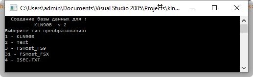
>> Добавлена возможность вывода в разных форматах:
1 - формат KLN90B
1 - формат TEXT
1 - формат FSHOST_FS9
1 - формат FSHOST_FSX
1 - формат ISEC.TXT
История версий:
= 2
>> Добавлена возможность чтения сценариев если они установлены на другом диске, например:
- когда сценарии находятся в папке симулятора
в файле scenery.cfg в разделе:
Local=Addon Scenery
но когда в разделе указано:
Local=d:\AddonScenery
или на другом диске, то ни KLN90B ни прежняя версия не видела такие сценарии.
>> Добавлена возможность вывода в разных форматах:
1 - формат KLN90B
1 - формат TEXT
1 - формат FSHOST_FS9
1 - формат FSHOST_FSX
1 - формат ISEC.TXT
→ Size:
108 KB
→ Date:
9 years ago (18.09.2016 20:19)
→ Author:
→ Approved by moderator:
d142b2f2641777e282c4372670140934
→ License:
Freeware - Free version, Unlimited Distribution
→ Downloaded:
205 time(s)
Yes, of course I will help you understand the operation of the program.
- The format of the coordinates 55°58′22″N 037°24′53″E you can see in the FS9 or Programs that create scripts (ADE, AFX).
For the program's there is no difference in what coordinate format, translates it into their system (dd.ddddddd), and even in all the files of the APT, WPT, NDB, VOR will record in its format.
#######################################
APT.DAT
Lon=[30.893333] Lat=[50.344722] Alt=[130.150000] ICAO_ID=[UKBB] NAME=[Boryspil International] CITY=[Kyiv] COUNTRY=[Ukraine] MV=[6.00]
$$$$$$$$$$$$$$$$$$$$$$$$$$$$$$$$$$$$$$$$
NDB.DAT
Lon=[-17.050028] Lat=[20.861325] ICAO_ID=[PS] Type=[0] REGION_ID=[GQ] APT_ID=[GQPP] FREQ=[00287000] NAME=[NOUADHIBOU]
&&&&&&&&&&&&&&&&&&&&&&&&&&&&&&&&
VOR.DAT
Lon=[-5.890806] Lat=[35.728805] FREQ=[115900000] TYPE=[3] ICAO_ID=[TNG] Alt=[32.000000] REG_ID=[GM] APT_ID=[0] NAME=[TANGER] DME=[YES] MV=[-2.00]
########################################
PS This programa this is KLN, just as the program's console − vova25305, 9 years ago, #
Yes, of course I will help you understand the operation of the program.
- The format of the coordinates 55°58′22″N 037°24′53″E you can see in the FS9 or Programs that create scripts (ADE, AFX).
For the program's there is no difference in what coordinate format, translates it into their system (dd.ddddddd), and even in all the files of the APT, WPT, NDB, VOR will record in its format.
#######################################
APT.DAT
Lon=[30.893333] Lat=[50.344722] Alt=[130.150000] ICAO_ID=[UKBB] NAME=[Boryspil International] CITY=[Kyiv] COUNTRY=[Ukraine] MV=[6.00]
$$$$$$$$$$$$$$$$$$$$$$$$$$$$$$$$$$$$$$$$
NDB.DAT
Lon=[-17.050028] Lat=[20.861325] ICAO_ID=[PS] Type=[0] REGION_ID=[GQ] APT_ID=[GQPP] FREQ=[00287000] NAME=[NOUADHIBOU]
&&&&&&&&&&&&&&&&&&&&&&&&&&&&&&&&
VOR.DAT
Lon=[-5.890806] Lat=[35.728805] FREQ=[115900000] TYPE=[3] ICAO_ID=[TNG] Alt=[32.000000] REG_ID=[GM] APT_ID=[0] NAME=[TANGER] DME=[YES] MV=[-2.00]
########################################
PS This programa this is KLN, just as the program's console. − vova25305, 9 years ago, #
But let me show you what appears in FS9 that makes me think that something is not right, look at the coridinates -> http://postimg.org/image/nexsghist/
And in generated PTT_APT -> Lon=[22,713594] Lat=[51,240177] Alt=[193,000000] ICAO_ID=[EPLB] NAME=[Port Lotniczy Lublin] CITY=[Lublin] COUNTRY=[Poland] MV=[-0,00]
This when I choose first option "1 - KLN90B".
There should be "DOTS" instead of "COMAS" (like this -> Lon=[22.713594] Lat=[51.240177] Alt=[193.000000] ICAO_ID=[EPLB] ) when I changed comas to dots, everything started to work. So I wonder this is my Windows fault or I misunderstood work of your program or could be something else?
Thank you for your response and support! − vesper, 9 years ago, #
It is the system itself. It is necessary to change the decimal part.
Control Panel -> language and regional settings -> tab - "Format".
at the bottom of the "Advanced Settings". and "the decimal part of the" change a comma to a point. − vova25305, 9 years ago, #